Log in
All resources
Create a design
19 Free Artworks of 17th Century Maps Showing History
maps showing 17th-century history
maps by pieter van der keere
bibliothèque nationale de france
maps by abraham ortelius
maps by alexis-hubert jaillot
maps made in the 17th century
17th-century maps of the netherlands
17th-century maps of belgium
maps of roman belgium
the comprehensive history of england (1876)
the voyage of the vega round asia and europe
third voyage of willem barentsz
prints from dankaerts historis at the peace palace library
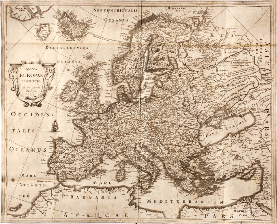
cornelis danckerts (i)
maps by alexis-hubert jaillot
maps by nicolas sanson
old maps of rhineland-palatinate
old maps of alsace
maps of nieuwkoop
aarlanderveen
bermuda in the 17th century
castle harbour, bermuda
history of weißenfels
baroque
17th-century maps of the mediterranean sea
copper engravings
maps by pieter van der keere
maps by abraham ortelius
library of the university of vienna
map of vienna by jacob hoefnagel
maps by pieter van der keere
maps by abraham ortelius
johann david schleuen
old maps of prussia
17th-century maps of moscow
16th-century maps of moscow
the comprehensive history of england (1876)
english-language maps showing history
the comprehensive history of england (1876)
english-language maps showing history
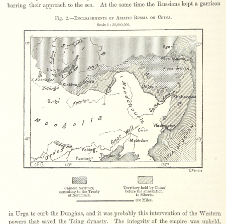
maps from the earth and its inhabitants, vol. vii
russian conquest of siberia
maps of saint paul's journeys
maps by pieter van der keere
philippe de la rué
maps of mysia
dutch 17th-century prints in the rijksmuseum amsterdam
capture of wesel 1629
1 - 19 of 19
/ 1